phandalin-map

Image Metadata
- Mimetype
- image/png
- File Size
- 715,643 bytes
- Image Size
- 566x494
Other Sizes: thumbnail(150x150) medium(300x262) medium_large(566x494) - Alt Text
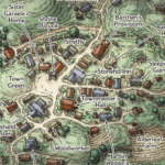
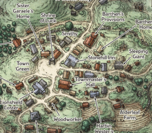
- A map of the village of Phandalin showing several locations including Shrine of Luck, Townmaster's Hall, Town Green, Stonehill Inn, Sleeping Giant, Barthen's Provisions and Alderleaf Farm
- Caption
- A map of Phandalin
- Copyright Status
- This file is derived from one on D&D Beyond and used under their Terms of Service, specifically Clause 1.4 which grants: "a limited, non-exclusive, and non-transferable license to use the Digital Content for personal, non-commercial entertainment purposes only". As such users of this site are not licensed to use this file for any other purpose.